Ever since we had moved to Botswana nearly a year ago, I had been itching to travel to the vast salt pans that dominate the country’s middle. With a trip planned in March to visit the Nata Community Library, I had been eyeballing Kukonje Island (labeled Kukome on Google Maps) as a likely candidate for a great wild camp stopover on our way north. But, every time I checked in on the Africa travel forums and Facebook groups, the story was the same – the pan was flooded, and the island inaccessible.
A nearby coordinate marker on the crowd-sourced traveling app iOverlander was labeled “Pebble beach toward Kukonje”, and the description suggested that it was a back-up possibility should the road to Kukonje Island’s campsites prove to be impassable. Given Botswana’s recent stretch of historically rainy wet seasons, settling for the backup campsite was looking likely. There was only one way to find out.


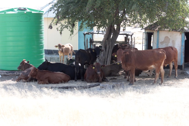
These cattle, in what can only be a retaliatory move, occupied an abandoned veterinary fence guard station. Botswana is slowly decommissioning (through both intention and plain old neglect) its vast network of vet fences.
A rocky prominence of Baobab and camel thorn trees, Kukonje Island rises from the eastern stretches of Sowa Pan in central Botswana. Sowa is one of the largest salt pans in Africa, and part of the biggest network of salt pans on the globe – the Makgadikgadi. The remnants of an ancient inland sea, the Makgadikgadi Pans sprawl over some 12,000 sq miles of Botswana (a land area larger than Belgium). For perspective, South Camp at Nxai Pans National Park, where we stayed over the Easter holidays, at the northern edge of the Makgadikgadi complex is nearly 300 miles from Kukonje.


Characterized by endless stretches of billiard table-smooth salt flats, the Pans are punctuated by “islands” that break up the mesmerizing continuity at irregular intervals. Rising just over a few dozen or so vertical feet from the pans themselves, these islands can be seen across incredibly long distances, and they have been waypoints of migration, commerce, culture, and spirituality for thousands of years.
One can see why.


The salt pans have a notorious and well-deserved reputation for stranding overland travelers since humans have started trekking across its expanse. The sheer barrenness, the disorienting sense of space, the shifting skyline (the curvature of the earth itself is easily perceived here), and bottomless sinkholes of slippery mud that are nearly impossible to distinguish by sight from the hard-packed salt, all conspire to lure the inattentive traveler into paradoxical dead ends where the horizon stretches in 360 degrees. Getting stranded or lost is no laughing matter.


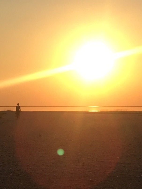
But that’s a possibility only when the pans are dry. We found Kukonje Island, a mere three miles from the primary gravel road, surrounded by water as in ancient times – a true island. Botswana’s rainy season hadn’t given up just yet, so we were relegated to the substitute campsite on the gravel by the “shore” of the vast salt pans. Kukonje shimmered in the distance, tantalizingly just out of reach.
Initially a bit disappointed, this proved to be one of the best wild camps we have had in Botswana, and maybe anywhere. We simply chose a spot on the pebbles among the random clumps of widely spaced thorn trees. The isolation and silence were overwhelming – even the birds, one’s constant companions in this country, stayed away. For a day or so we did hardly anything but chase the meagre shade around the Pajero and stare into the void, barely speaking. Perfect.


The Island itself will have to wait for a future adventure.

Oh I loved this so much. Thanks for sharing.
LikeLiked by 1 person
Thanks Beth! 🙂
LikeLike
Beautiful post Steve.
Glad to see the Pajero is serving you well and getting you to some great places over there.
Cheers.
LikeLiked by 1 person
Stay oriented and be safe. Interesting info and great photos.
LikeLiked by 1 person
Thanks! Yeah, it’s definitely easy to get turned around out on the pans, even with a good sat nav. We took a few wrong turns before we finally found where we were going. The crazy tangle of vet fences doesn’t help the situation in that area, either.
LikeLike
Thanks Anthony! It has served us well so far – but it’s looking like I’ll need to replace a front axle soon. Stay tuned for more!
LikeLike