Southern Africa presents some particular challenges for long distance travelers. As we prepare to embark on the most extensive overland journey we have ever attempted, I thought I would share some of how I approach organizing a trip of this magnitude.
Our departure date is December 19, 2017 and we won’t be returning to Gaborone until January 12, 2018. Along the way we will cross three international borders, camp in an extinct volcano, visit some of the most remote corners of the Kalahari Desert, track rhinos at sunrise, drive hundreds and hundreds of kilometers on dunes, gravel, and tar, and sleep out under the stars for a total of 21 nights.
I’ll be traveling on assignment for SA4x4: Overland Adventure Magazine, and I am very happy to introduce our vehicle and equipment partners for this expedition as well: Hi-Range Safari City out of Gaborone, Botswana, and its sister company Wild Wheels, based in Maun.
Hi-Range and Wild Wheels are currently preparing a special vehicle for this trip – more on that later next week.
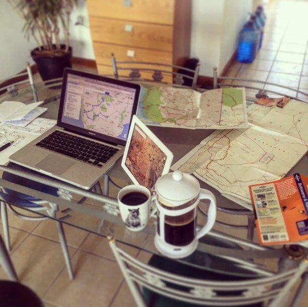
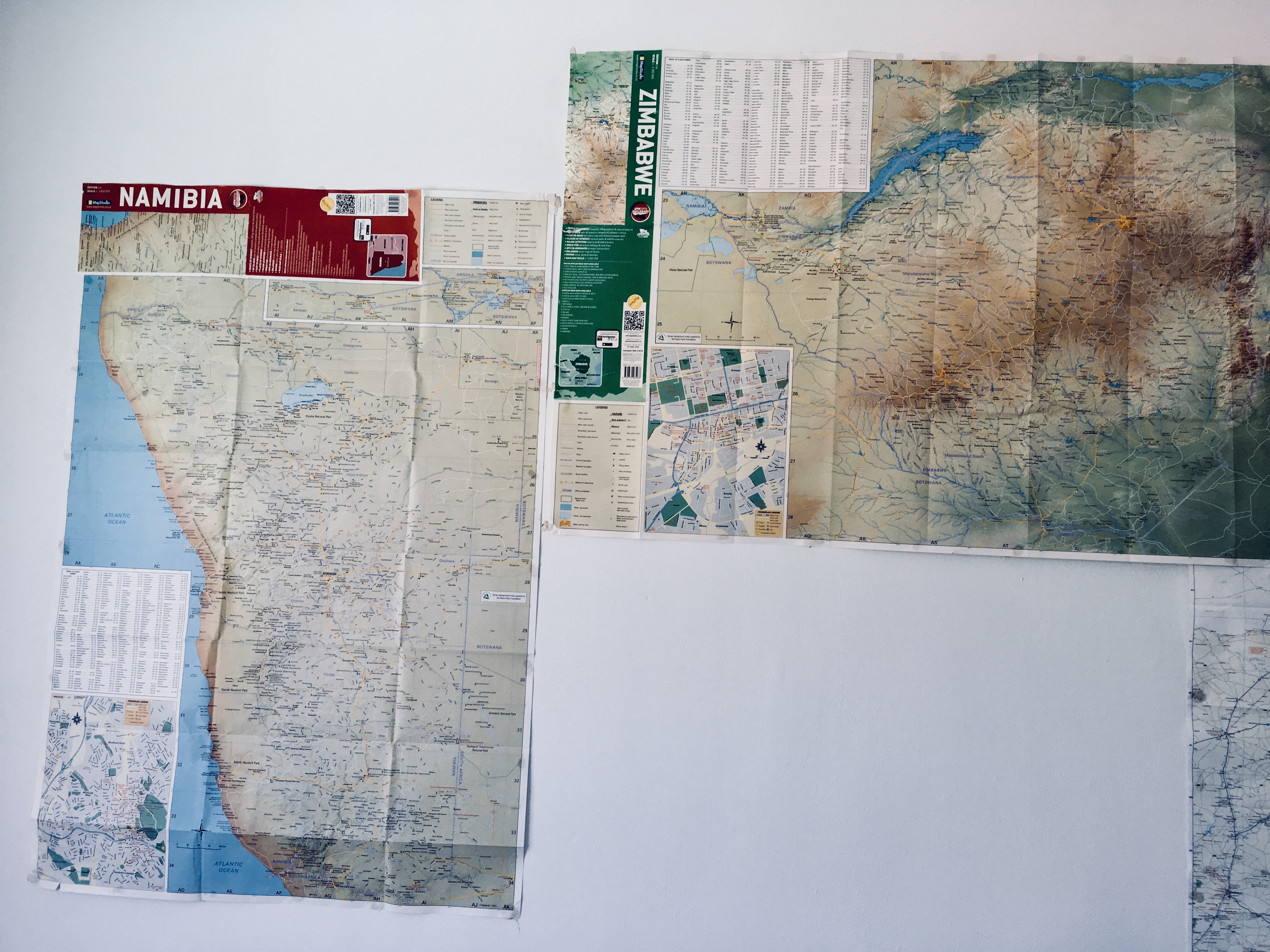
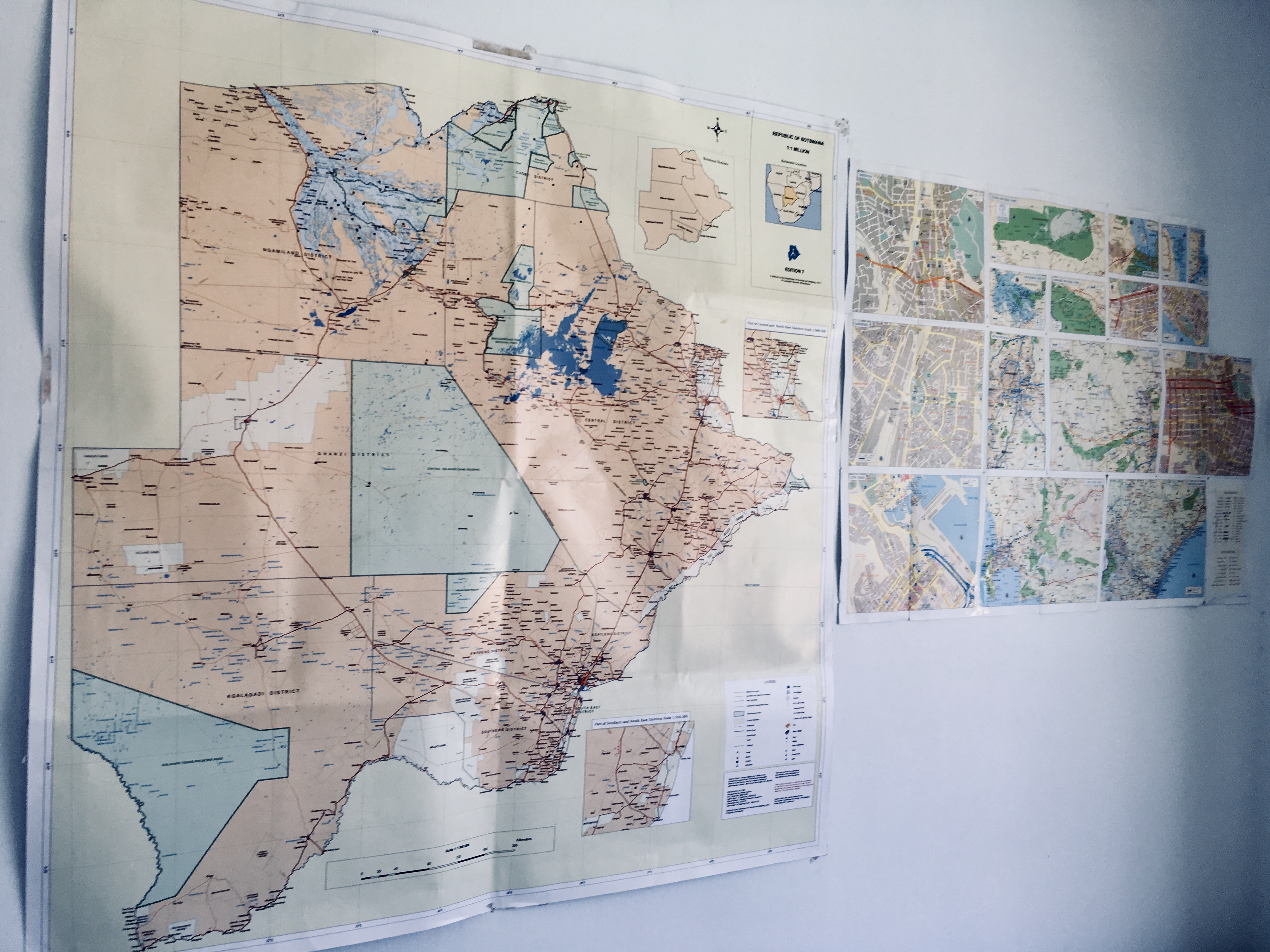
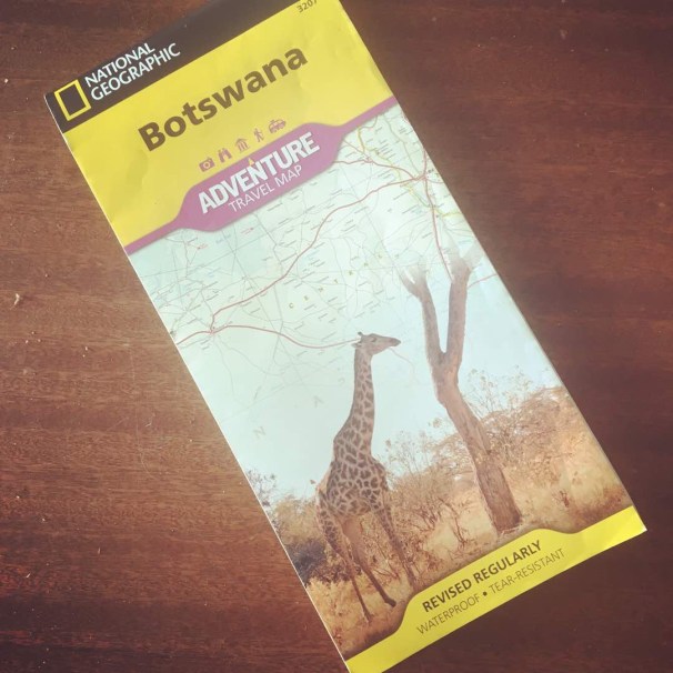
Before we get into the details, it’s best to take the large view, which is exactly how I begin to plan a journey like this one. For me it starts with maps – paper maps.
A paper map allows you to see scale, context, and detail all at the same time, something Google Maps or GPS data just can’t do. Bring the map close to your face, and you make out the fine-grained details of a particular location; tack it up and step back, and those details remain in context with all the others. Roads, place names, terrain features, and communities do not disappear as you move up and down in scale.
An expertly drawn map is a thing of beauty, and a tool unlike any other.
So I spread out my maps on the table, or fix them to the wall and let them reveal routes, locations, landforms – all of the possibilities. I began this process back in September, and I spent a lot of time just simply staring at maps. I often leave them folded on the bedside table, or in the living room or kitchen, any place I can casually pick them up and reconsider my options.
Of course, all those options can be overwhelming. I try to anchor the plan for a long trip around one place or experience we refuse to miss – this time it is a return to NamibRand Nature Reserve in southwestern Namibia. We spent two incredible (and cold!) nights there in 2015, and vowed we would do it again.
It’s a long way to Namibia from Gaborone, but that’s the whole point.
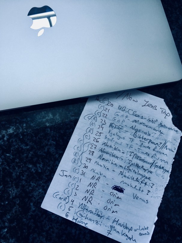
Only after a I develop a route in my imagination with the help of the cartographers do I dive into the details. This usually involves sketching out possible stopovers, camping options, and adventures between home base, the anchor destination, and back. I do this with pen, pencil, paper, and eraser.
These little scraps of paper lead me to that great schismatic tool of the overlander – the Internet.
I harbor no small amount of ambivalence toward the increasing mountain of data collected and shared by overland travelers in remote places. I relish the detail, the images, the narratives, and the peek behind the curtain. Hell, we are doing it right now on this very blog. It is part of what keeps us engaged and exploring. It keeps us inspired.
The rub is that all that information obscures some of the discovery. I believe that Julie leaves this planning process to me simply so she can see the new world unfold before her without prejudice, without bias. (She often ignores the links I send her regarding our future trips: “Does this look good”? “I don’t care, if you get us there, it will be good.”) We make a good team.
I unfold the maps. I can’t help it. With an assist from the wisdom of the Internet and physical guide books, through trial and error I lay out the route. Phone calls are made, emails sent. What is available? What is closed or impassable? What is new or different? How much does it cost? How do we get from A to B?
More information refines the process. A blueprint takes shape – driven by the organic, romantic, and random study of maps and formed by the focused research into the particulars that make a journey like this logistically possible. The inspiration and the planning go hand-in-glove.

Where are we?
Enough abstraction. Where are we going?
Beginning next week, we travel west from Gaborone to the Kgalagadi Transfrontier Park – a nature reserve built across borders by Botswana and South Africa. We will camp at one of the most remote places in all of southern Africa. We will relax over Christmas at a lodge where the menu is only in Afrikaans.
Our plans then take us next door into Namibia, where we will wild-camp where we find space and time, check in at friendly lodges, and return to NamibRand for a reunion with the first place that sealed our lifelong love of Africa.
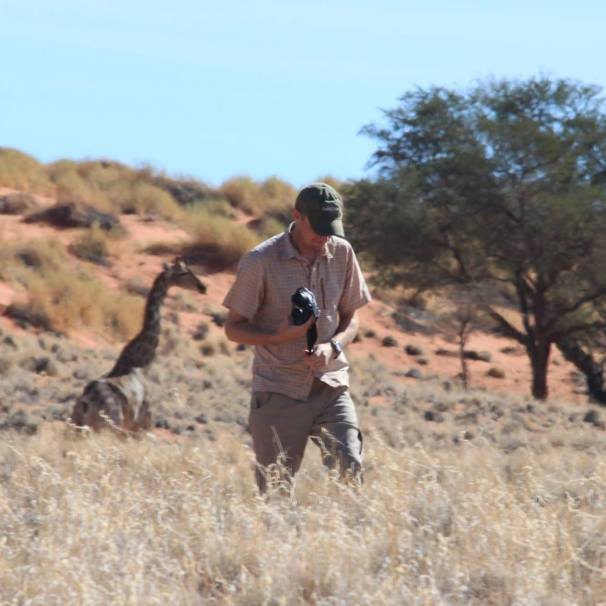
Me and a long-necked friend, NamibRand Nature Reserve, 2015.
Returning to Botswana, we look forward to a long journey through the great expanse of the Central Kalahari Game Reserve, a rendezvous with rhinos, and finally, home, to the city.
Follow along in the weeks ahead as we find the inspired, the planned, and the unexpected across southern Africa.

It warms my heart that you use paper maps, pencils, pens, erasers, and paper. I totally agree that the Internet is a beautiful place, however, only as a supplement. I realize that world relies and is addicted to technology, but do folks ever look up? And if I have a map on my phone, and need to turn it upside down to see which way is south, it just turns with me. A paper map remains my friend and does not switch directions. And as we plan our trip to Botswana, the paper is my strength.
Thank goodness for cartographers. If there hadn’t been math involved I would have been a cartographer or a meteorologist or an electrician.
LikeLiked by 1 person
Math was always my Achilles Heel. But I fear that I didn’t really apply myself to it in school, and might have done better if I had.
LikeLike